


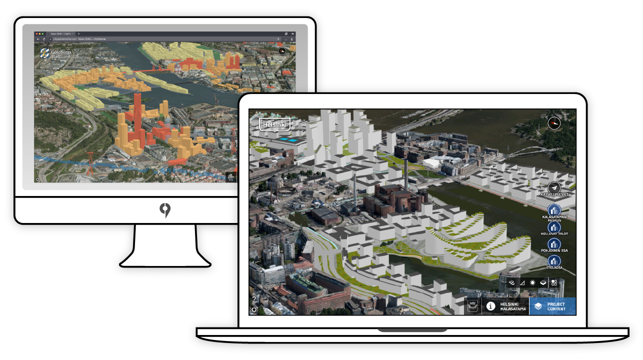
Publishing a standard website – any modern web browser can stream 3D projects directly to your audience, without need for plugins or downloads.
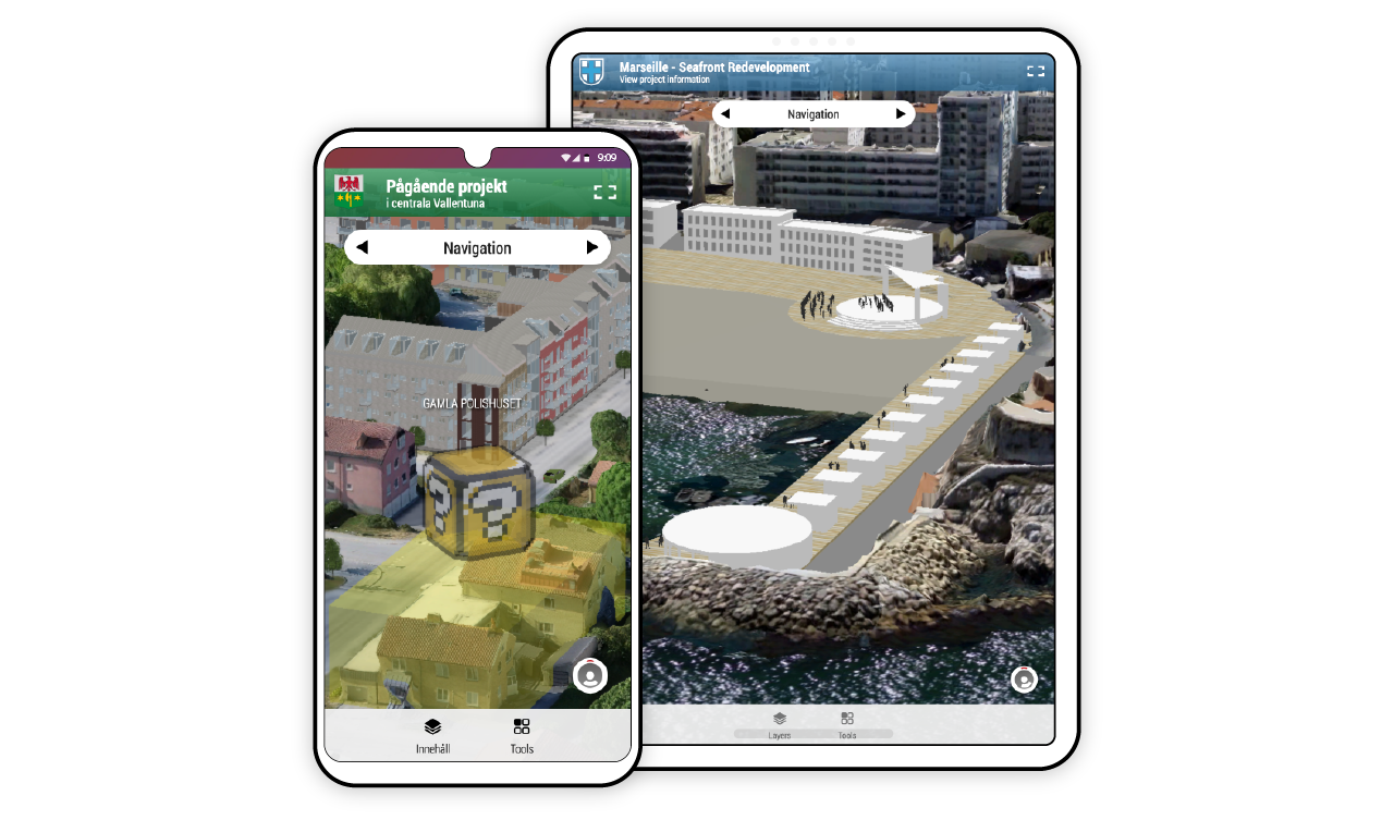

A dedicated mobile interface caters to a modern public. Optimize communication with the residents by designing projects mobile-first.

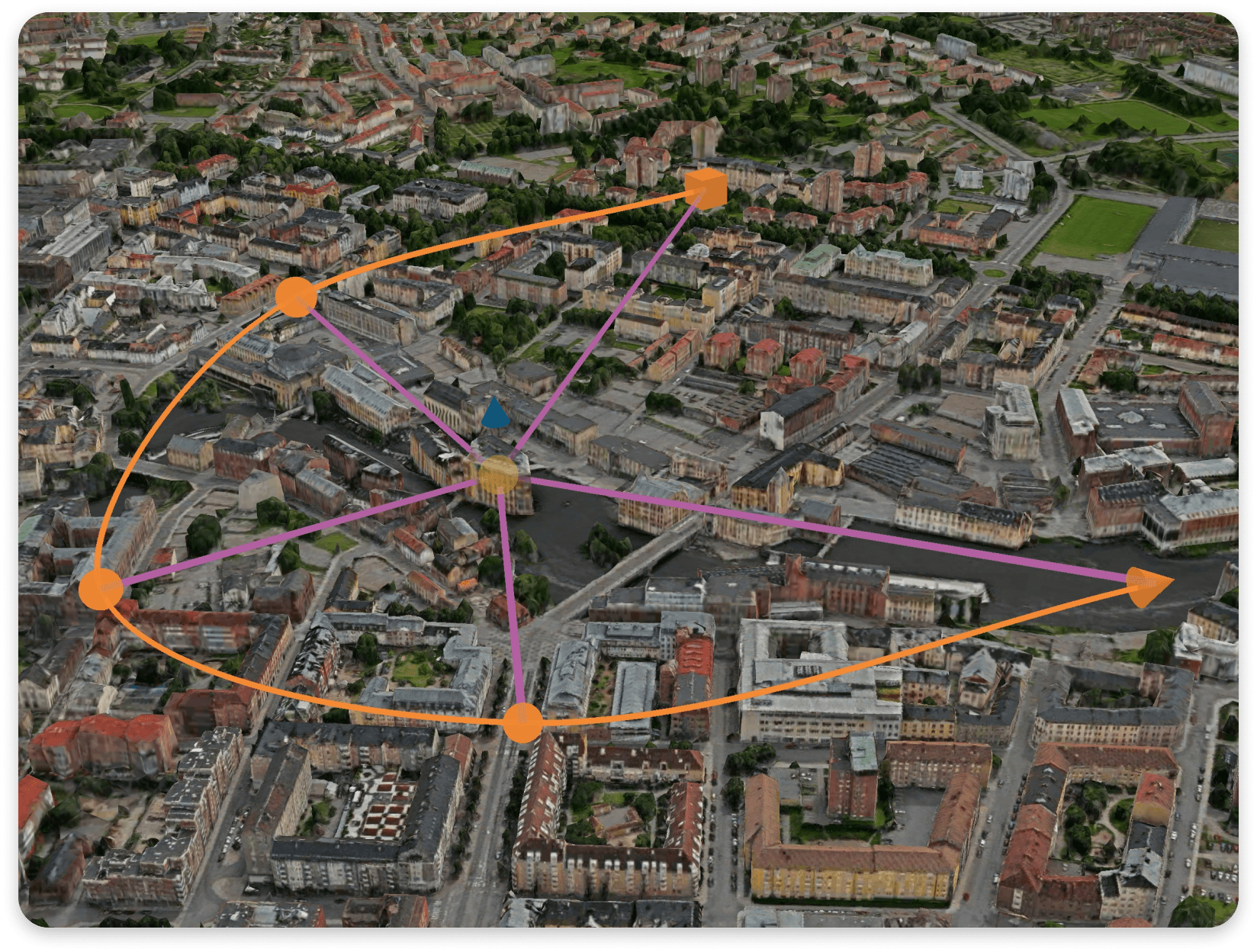
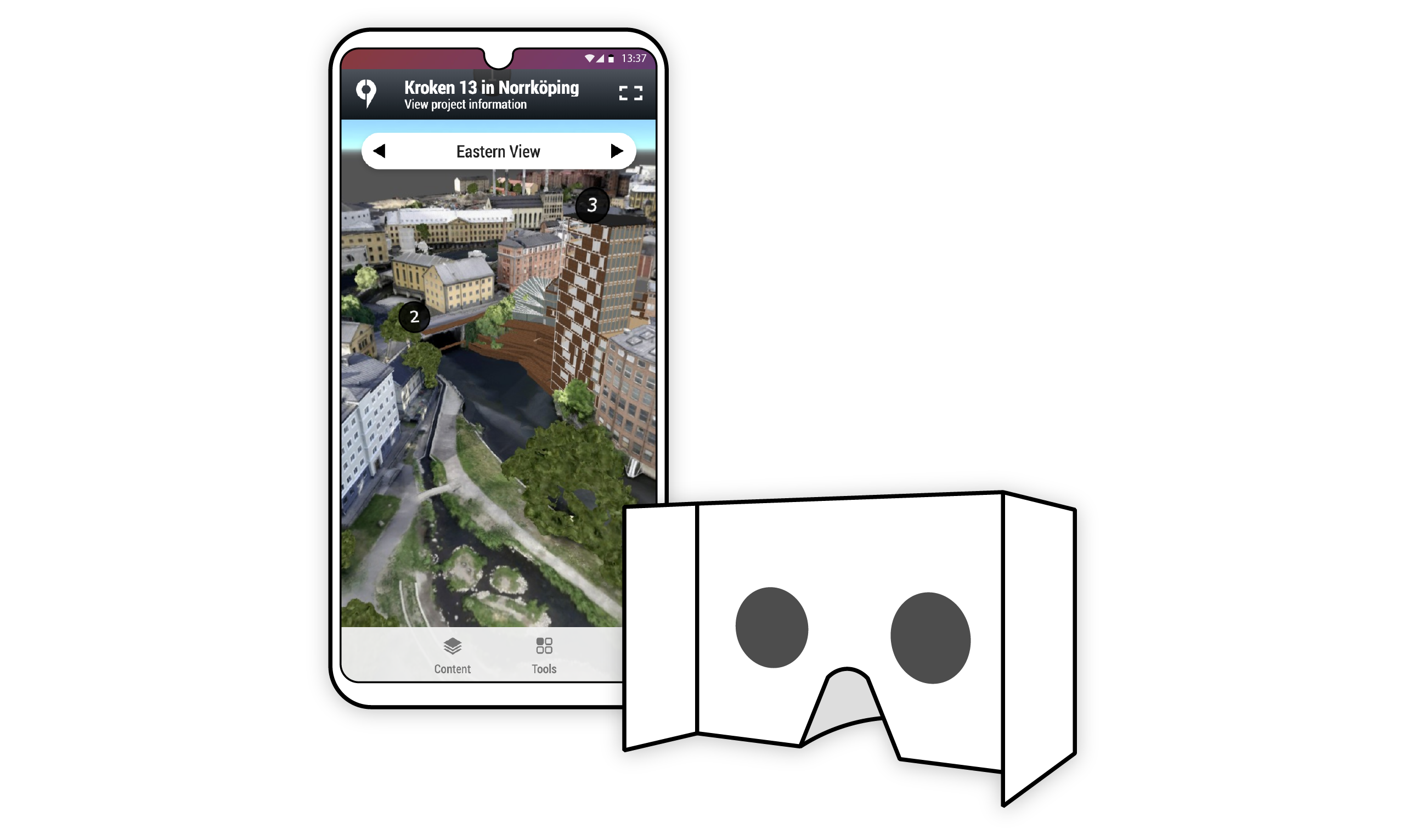
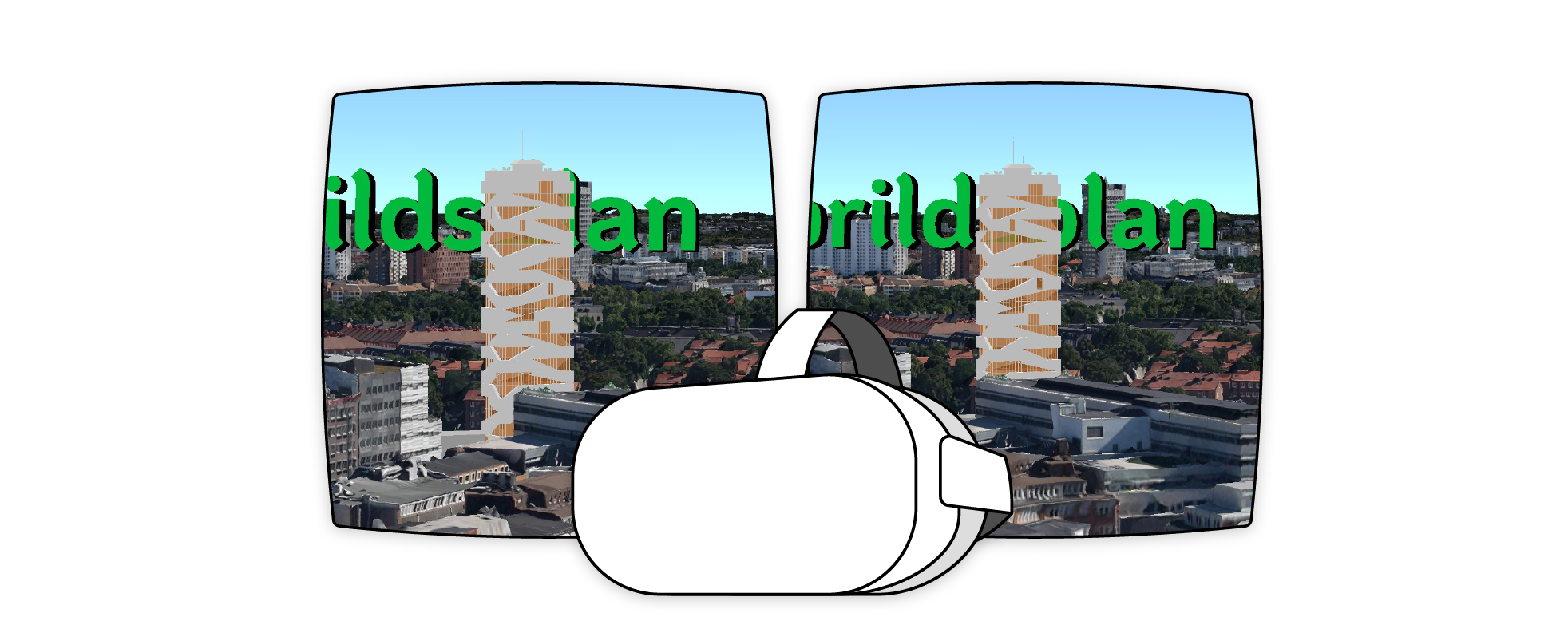
360° Panorama allows for targeting markets with data limits and lower end devices. It supports Google Cardboard for cost-effective virtual reality and allows administrators to develop on-the-rails 3D experiences.
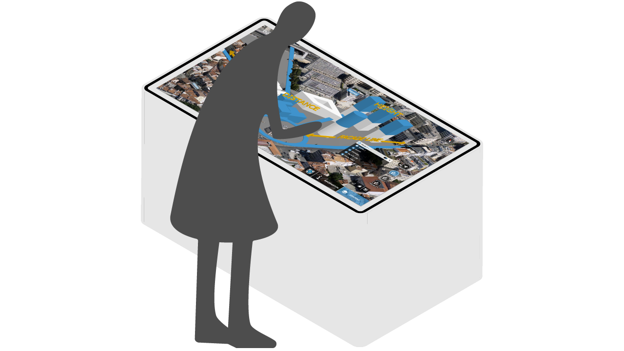

Showroom is a desktop application designed for exhibitions and touch-screens. Internet connectivity is not required, projects are downloaded to a local computer. High-end performance showcases your projects.

Virtual Reality – where the Real World meets the 3D World. Supporting HTC Vive and Oculus Rift, publish projects as fully immersive 3D experiences for internal planning and public exhibitions alike.
Reports & Analysis
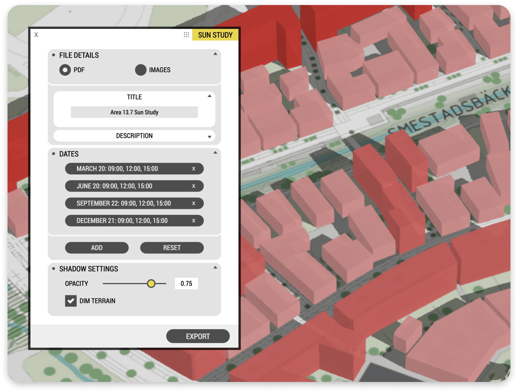
- Create Shadow Reports as a PDF or Images
- Export Video in 4K and 360°
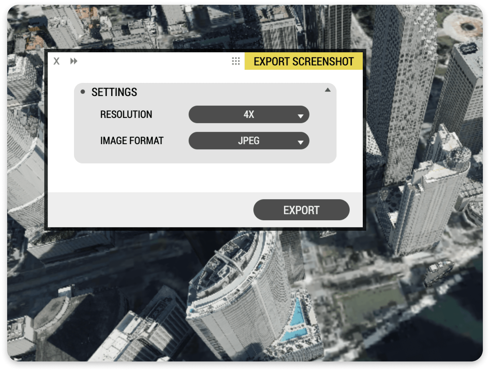
- Export High-Resolution Screenshots for Print and Publicity
- Export 360° Panorama Images
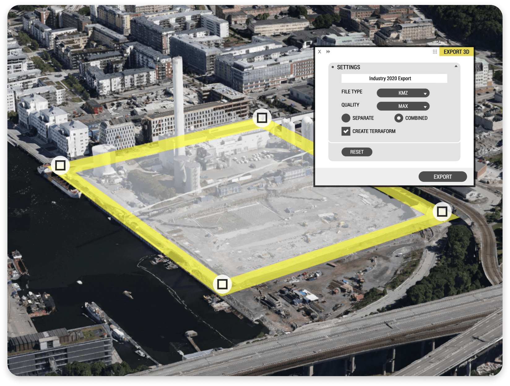
- Export 3D Data from Massive City Models
- Elevation Rendering Tool
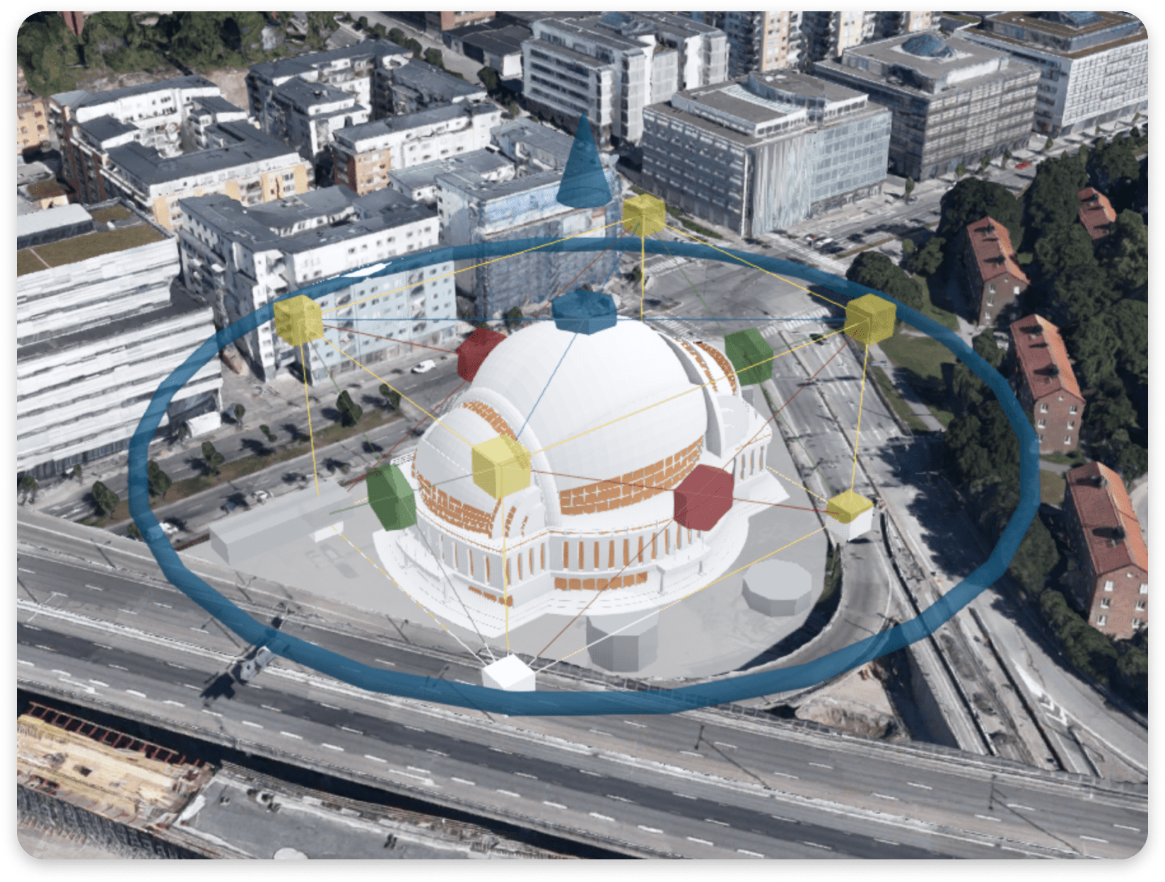
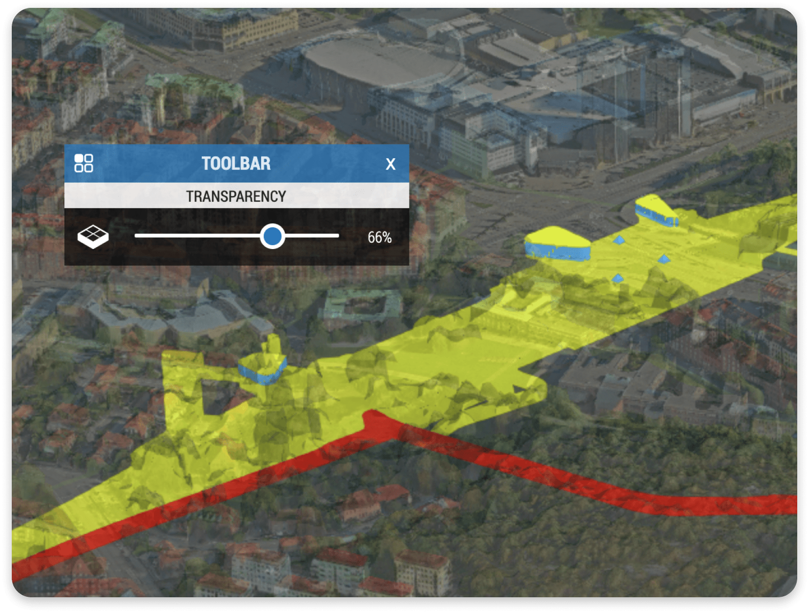
- Measure Distance, Height, and Area
Project Content Support
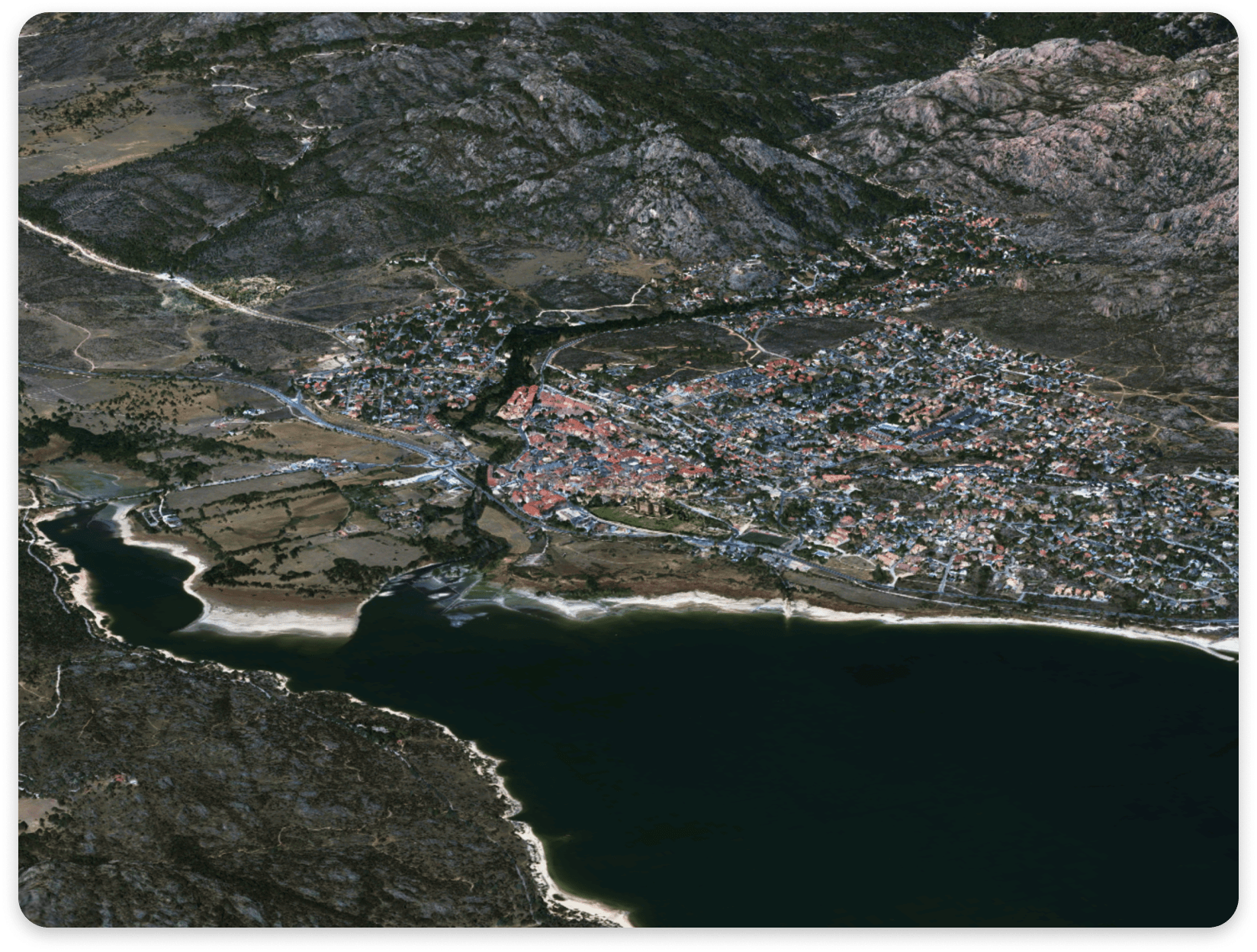
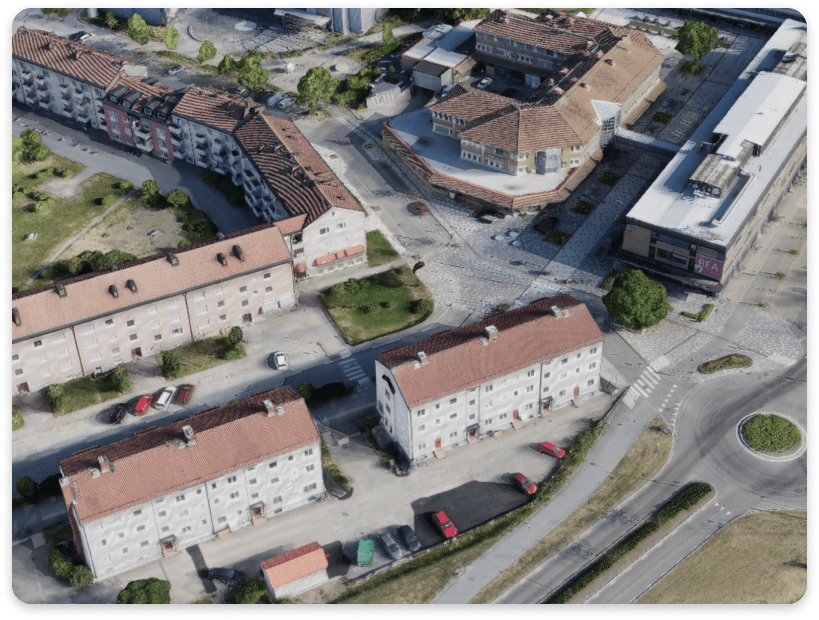
- Global OpenStreetMap 3D Datasets
- Lots of OpenStreetMap Styles, including Optional Terrain and Buildings
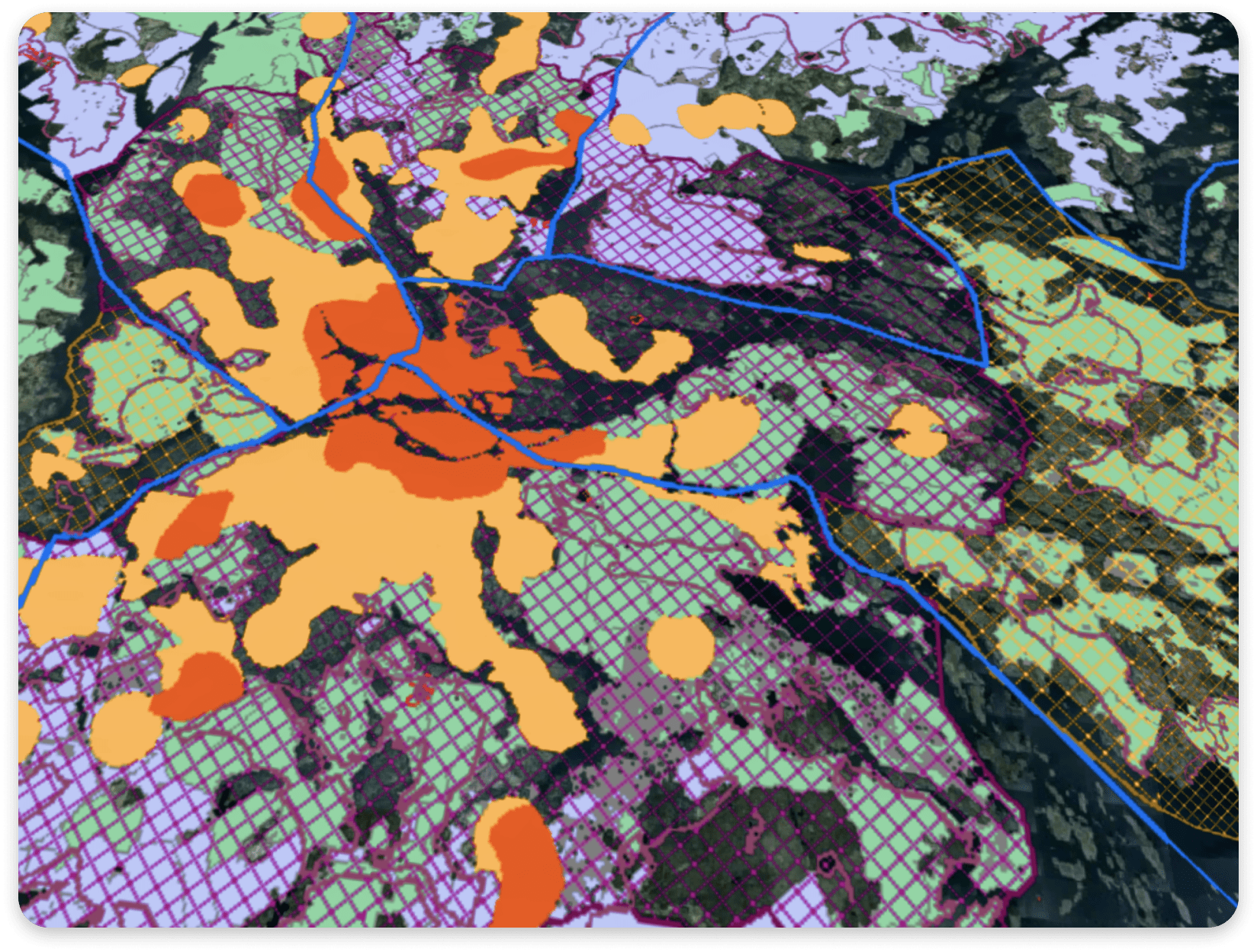
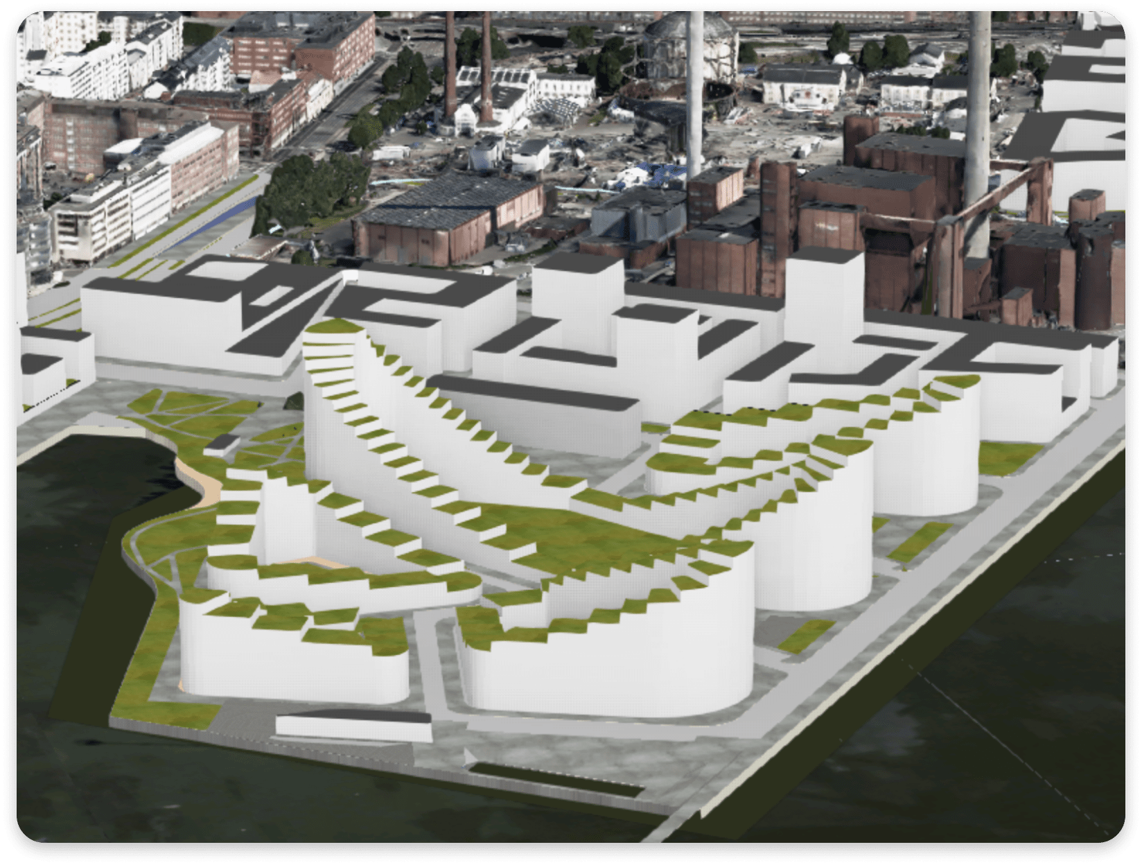
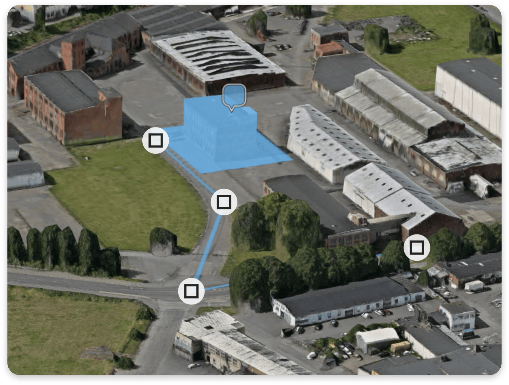
- Import Vector Data, Draw on Terrain, Extrude to 3D Volumes from Selected Attributes
- Add and Configure WMS Layers
- Manipulate Terrain and Virtual Demolition of Existing Buildings
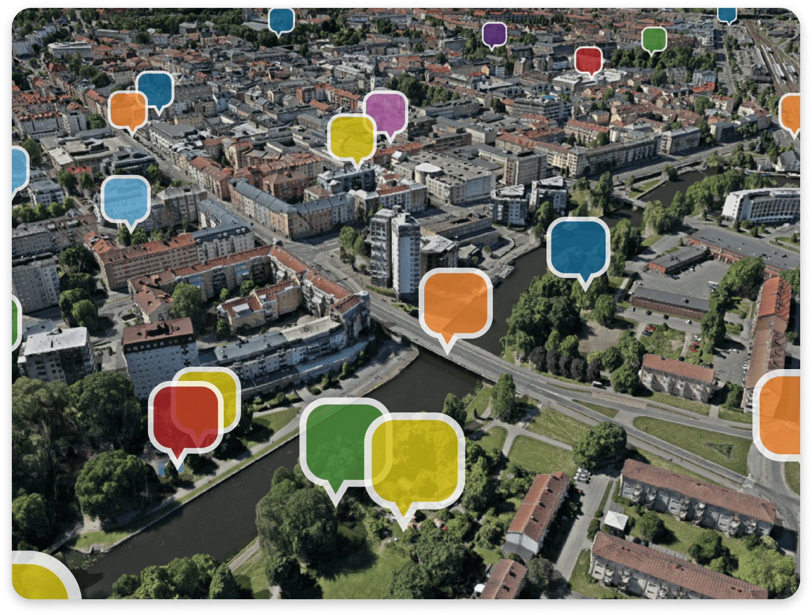
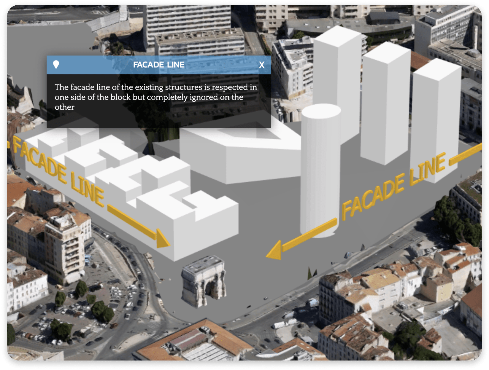
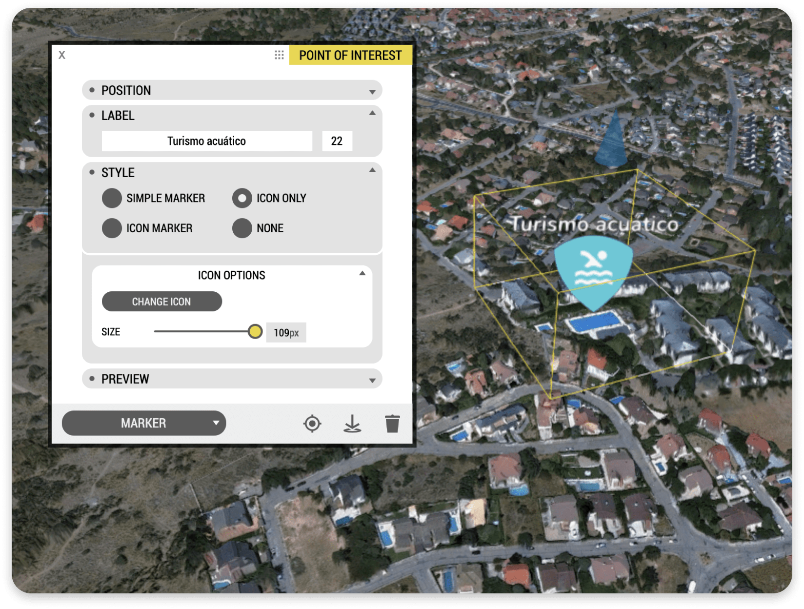
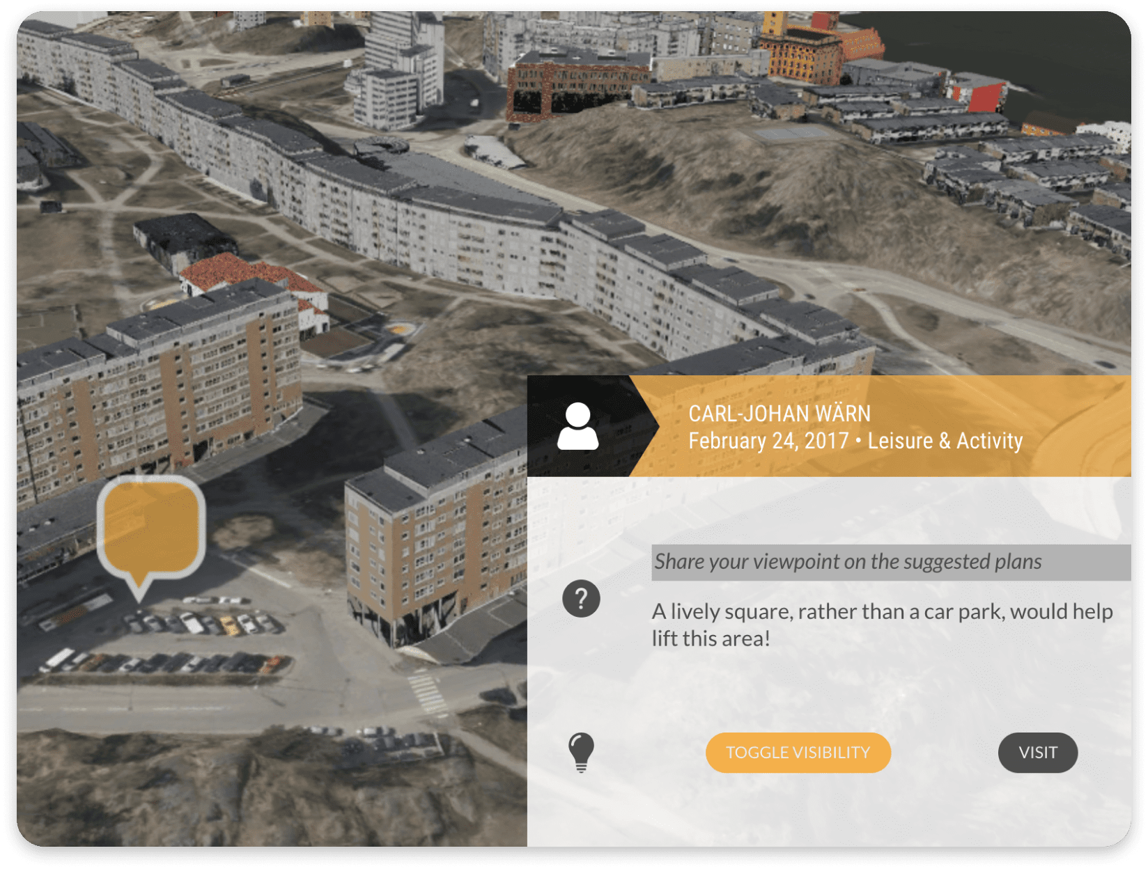
- Embed Websites and Multimedia in Points of Interest & Detailed Information Windows
- Add Custom Search Databases
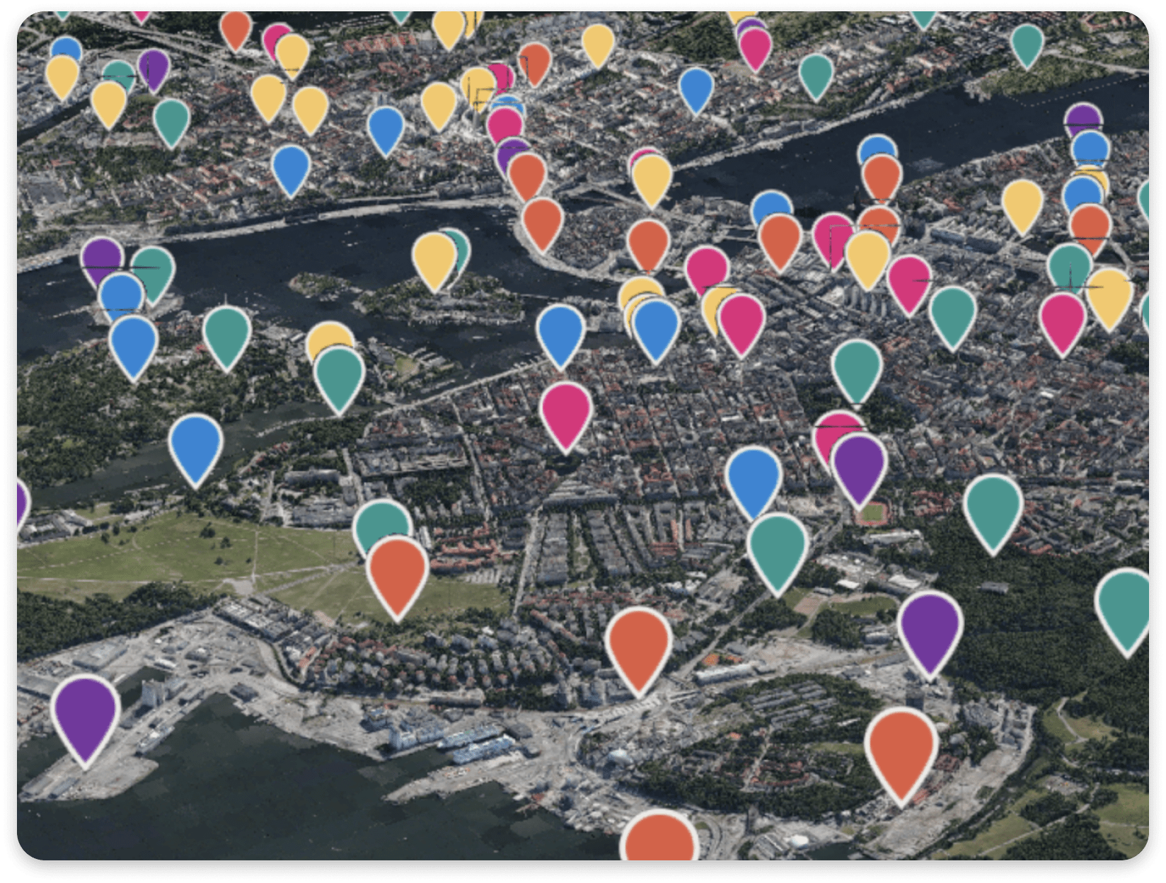
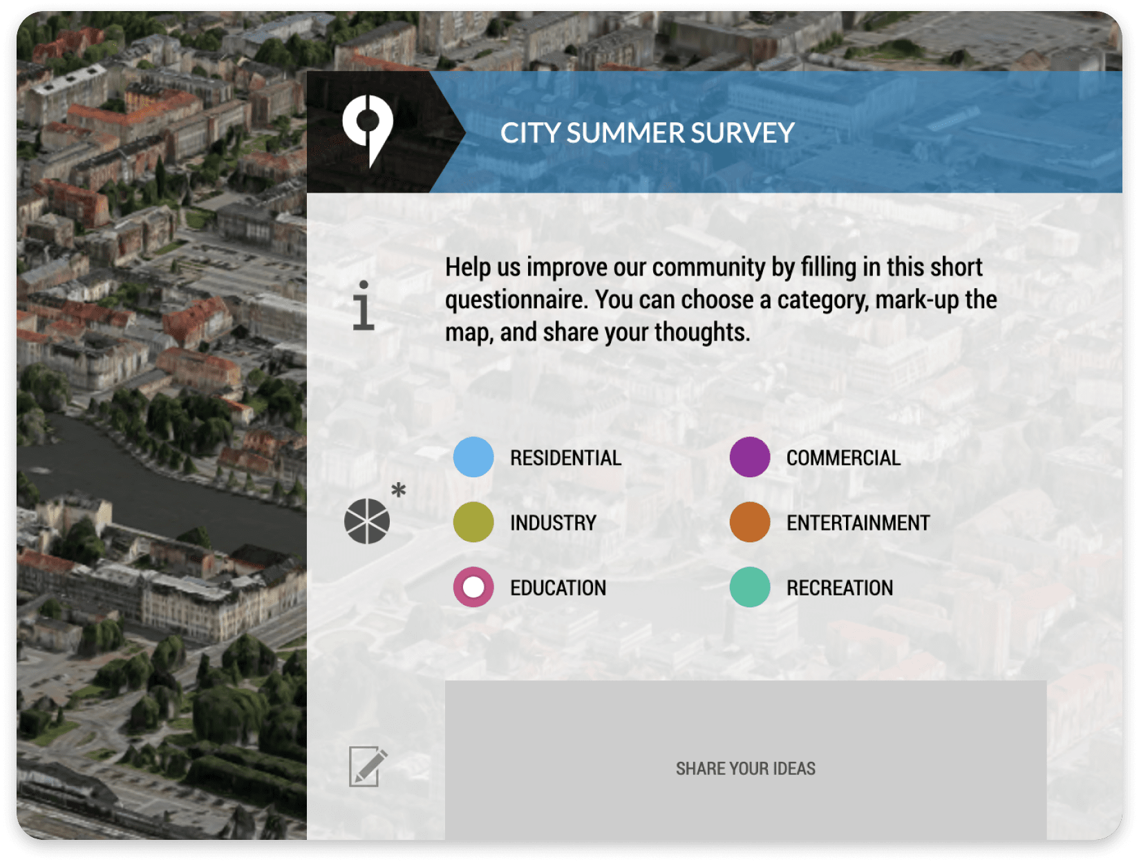
Interactive Questionnaires
- Build Highly Customizable Questionnaires
- Crowdsource Urban Planning Ideas, Civic Problem Reporting, and More
- Custom Questions with Multiple Choice & Single Option Response Support
- Configure 3D Drawing Tools, Study Satisfaction, Request Attachments, Collect Demographics, and More
- Export Responses as PDF, Shape, and Excel Files
- Generate Automatic E-mail Notifications on Form Submissions
Organization
- Connect Projects in a Unified View via Portals
- Organize Content into Groups & Layers
- Invite Team Members to View or Collaborate
- Match Your Graphical Profile with Customizable Palettes, Logos, Icons, and Typography
- Configurable User Roles with Different Access & Editing Privileges
- Scalable Price Model, Suits All Organization Types
Showrooms & Virtual Reality
- Desktop Application for Showrooms & Exhibitions
- Full-Featured V.R. Experience in Massive City Models
- Mobile V.R. with Cardboard
- Content Always Synchronized Online
Technology
- No Installations, Plugin-free – Just Use a Web Browser!
- Cloud Service, Get Started Today